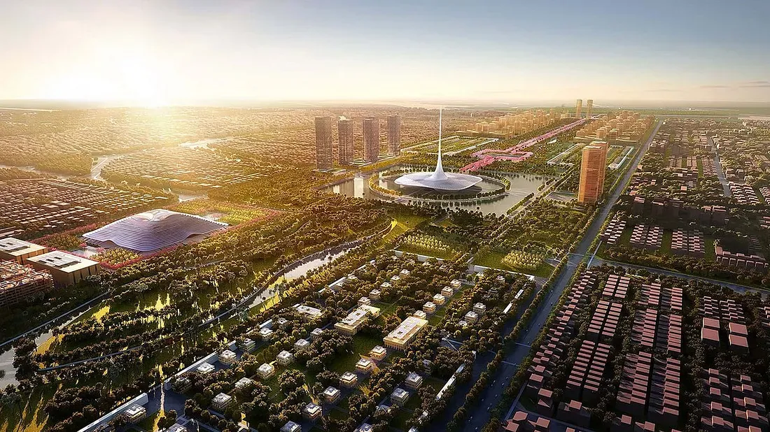
The convergence of physical and digital realms has dramatically altered the landscape of urban planning. At the heart of this transformation lies digital and virtual twin technology, dynamically updated replicas of physical assets, processes, or entire urban environments. These powerful systems offer real-time monitoring, advanced analytics, and predictive capabilities, enabling city planners, architects, and policymakers to visualize impacts, optimize operations, future-proof city infrastructure, and enhance citizen well-being. As urbanization accelerates and the pressures of climate change mount, digital twins stand poised to become invaluable tools in city planning worldwide.
What is a Digital Twin in City Planning?
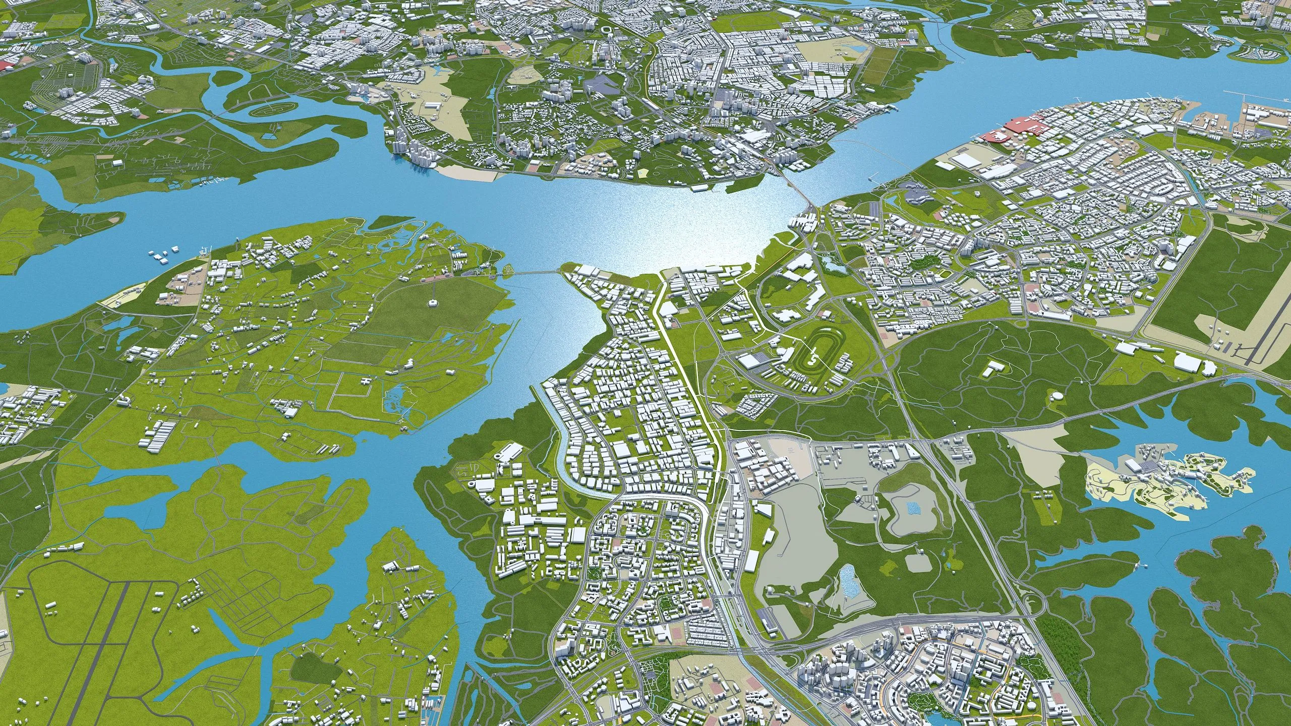
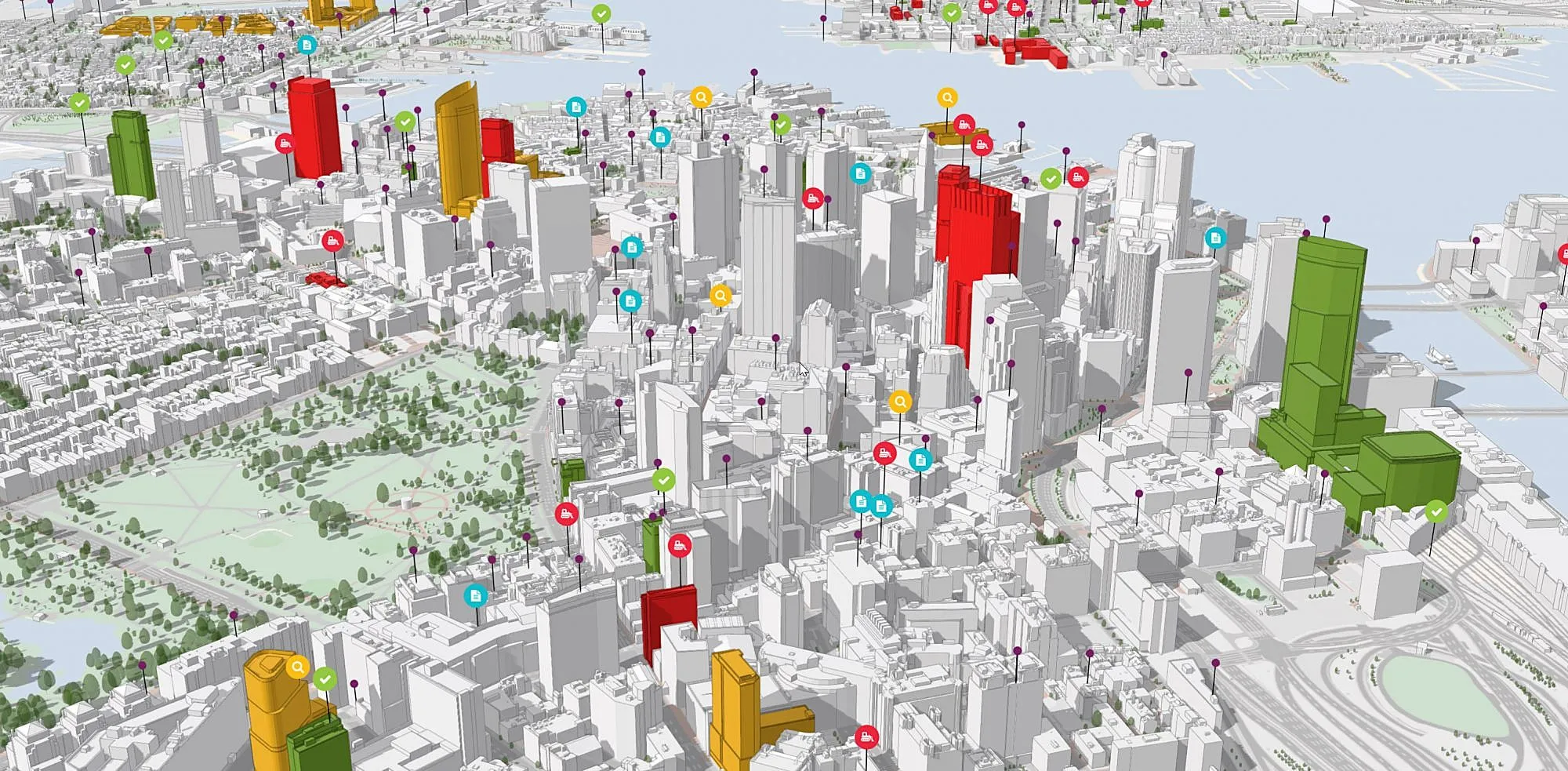
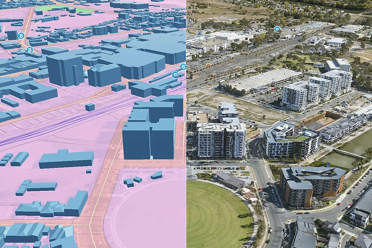
A digital twin in city planning is a highly detailed, data-driven model mirroring the physical realities of an urban environment. This can range from a single building or bridge to an entire city, where live data from sensors and IoT devices continually updates the twin, reflecting current conditions. City planners can use these models to analyze everything from energy usage patterns and traffic flow to social dynamics and disaster resilience.
Digital twins distinguish themselves from traditional 2D or 3D models by their dynamic nature. They don't represent a design at a single moment in time; they evolve continuously, assimilating real-world data streams. They are making “what if?” scenario testing genuinely actionable.
Core Benefits of Digital Twin Technology in Urban Planning
Digital twins are decision accelerators. Their adoption in urban planning is driven by several core benefits:
Real-Time Monitoring and Analysis
Cities can monitor critical systems like traffic, utilities, pollution, and water supply. They use sensor data integrated into the digital twin. This live feedback allows for prompt interventions, proactive maintenance, and mitigation of risks before they escalate.
Predictive Simulation
Urban planners can simulate the consequences of new policies, infrastructure upgrades, or environmental changes before implementation. This approach reduces the risk of costly errors and facilitates consensus-building among stakeholders.
Cost and Resource Optimization
By playing out interventions in virtual space first, cities minimize unnecessary spending on ineffective projects. Digital twins enable cities to allocate resources more precisely, improving operational efficiency and investment outcomes.
Sustainability and Resilience
Digital twins support the integration of climate projections, allowing cities to model and adapt to floods, heatwaves, and other environmental risks. Data-driven planning strengthens resilience and informs sustainable urban growth.
Enhanced Stakeholder Engagement
Highly visual, interactive models make urban planning more democratic. The public, decision-makers, and technical experts can all understand and explore proposals in an intuitive 3D environment, promoting transparency and collaboration.
Global Examples of Digital Twin Implementation in City Planning
Around the world, cities have begun leveraging digital twin technology to tackle complex urban challenges. The following case studies exemplify varying applications and unique outcomes:
1. Virtual Singapore
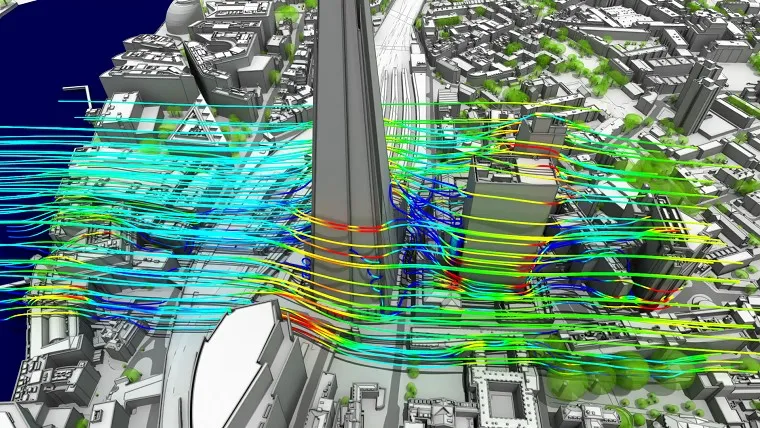
Perhaps the world's flagship example, Virtual Singapore, is a city-scale digital twin that models the entirety of Singapore in 3D, integrating real-time data on everything from traffic flows to climatic conditions. Planners and agencies use the platform to analyze urban mobility, energy efficiency, shadow casting of proposed developments, and even the social implications of zoning changes. Virtual Singapore also enables planners to simulate emergency scenarios, such as chemical spills, assess urban heat islands, and optimize building placement for ventilation and shading.
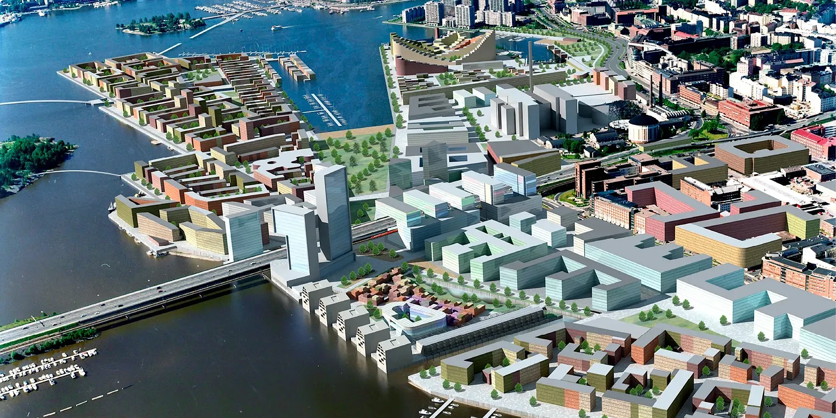
2. Helsinki, Finland: Smart City Digital Twin
Helsinki has developed a digital twin ecosystem combining 3D city modeling and data integration. This platform addresses sustainability goals, including energy reduction and emission control, by simulating proposed building retrofits or renewable energy integration. The system allows city officials to visualize and manage construction projects, analyze travel patterns, refine zoning codes, and anticipate flooding under different climate scenarios.
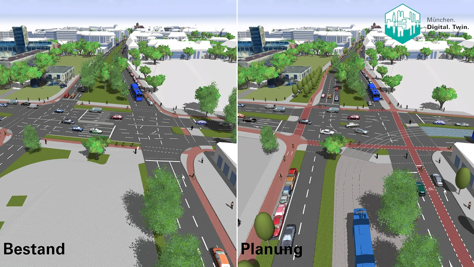
3. Munich's Digital Twin (DT-M)
Munich’s digital twin utilizes artificial intelligence to model physical infrastructure, energy, and mobility as interconnected systems. Notably, Munich’s twin is used to evaluate the feasibility of green roofs and solar panel installations, map cultural site accessibility via public transport, and track the environmental impact of policy shifts. It also serves as a tool for community engagement. Residents can interactively visualize various urban scenarios, directly informing participatory planning processes.
4. Bologna, Italy: Local Digital Twin
Bologna is pioneering a digital twin combining physical data with social interactions and urban dynamics. The platform supports mobility planning, climate adaptation strategies, and energy management, with a particular focus on citizen participation. By modeling infrastructure and patterns of human activity, Bologna can assess the real-world impact of new policies before rolling them out.
5. Amaravati, India: Greenfield City-Twin for Futuristic Planning
India’s planned city of Amaravati in Andhra Pradesh is building a city-wide digital twin from its inception. The twin supports everything from urban design and construction oversight to efficient utility management and disaster planning. By integrating the twin into city operations from day one, Amaravati stands as a template for how future cities, especially in rapidly urbanizing regions. This can avoid legacy infrastructure pitfalls and leapfrog directly to smart, resilient urban governance.
6. Digital Twin of Boston, USA
Boston’s adoption of digital twin technology is transforming how the city coordinates repairs for underground utilities, surface infrastructure, and public amenities. Planners can now efficiently schedule interventions across water, sewage, electricity, and transit systems, reducing disruptions for residents. The digital twin is also used in design review to analyze the impact of new developments, including shadow casting and wind flow effects on public spaces.
7. Sydney, Australia: NSW Spatial Digital Twin
Sydney’s digital twin supports long-term strategic planning, including the simulation of population growth, infrastructure expansion, and environmental change. Asset managers use the model to monitor the health of bridges, rail lines, and public spaces, prioritizing interventions that maximize durability and improve sustainability outcomes.
From Traffic Optimization to Climate Resilience
Digital twins unlock a spectrum of possibilities in urban planning. Some leading applications include:
Traffic Optimization
Urban areas worldwide grapple with congestion. Digital twins process real-time traffic and transit data, simulate proposed interventions (e.g., adjusting signal timings or introducing new bus lines), and forecast the ripple effects on travel time, emissions, and road safety.
Disaster Management and Resilience
By simulating floods, earthquakes, or extreme weather, digital twins enable cities to optimize evacuation plans, deploy emergency assets, and assess infrastructure vulnerabilities. Terrain mapping integrated with real-time sensor feedback improves readiness and recovery.
Energy Efficiency and Carbon Management
Cutting-edge digital twins can combine building performance simulations with live sensor data to identify energy-saving opportunities, propose building retrofits, and monitor carbon emissions at the neighborhood or city scale.
Infrastructure Maintenance
Asset tracking in the digital realm enables predictive maintenance of roads, bridges, sewers, and public transit. Data-driven scheduling minimizes downtime, reduces costs, and extends the lifespan of critical infrastructure.
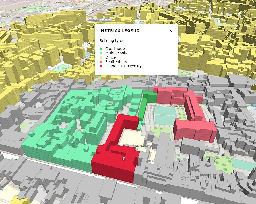
Urban Growth and Zoning
City officials use digital twins to test out zoning changes, optimize land use, and forecast the impact of new developments on existing neighborhoods. Interactive tools support evidence-based policy and stakeholder consensus-building.
Challenges and Limitations
Integrating digital twins into city planning poses notable challenges. One of the most significant is data integration. Urban environments generate information from a vast range of sources, including traffic sensors, weather systems, utility networks, and even citizen feedback. Chanellising these diverse and often siloed data streams into a single, reliable digital twin platform requires robust validation, standardization, and ongoing management.
Additionally, the technical complexity and high cost of developing high-fidelity digital twins present a barrier, particularly for smaller municipalities that may lack access to advanced technology and expert personnel. Although cloud-based solutions and open standards are easing adoption, the financial and skill-based requirements remain substantial hurdles.
Beyond technical and financial issues, concerns around privacy, security, and scalability are critical. Digital twins depend on real-time, granular urban data, raising the stakes for safeguarding citizen privacy and securing sensitive infrastructure information. Strong governance frameworks and transparent data policies are essential to protect public trust. Finally, scaling digital twin models, which initially found use in manufacturing, so that they capture the diversity of modern cities. Customizing solutions to local contexts ensures that digital twins deliver meaningful value.
Integrating AI, IoT, and Smart Governance
The next wave of digital twin innovation lies in integrating artificial intelligence, machine learning, and IoT networks. AI-enhanced digital twins can process live sensor feeds, detect anomalies, forecast trends, and optimize infrastructure in near real time. Open, interoperable platforms will support collaboration across government agencies, private enterprises, and citizens.
Public engagement will become more central, as interactive virtual cityscapes enable participatory design and dynamic policy feedback loops. In the years ahead, as digital twin solutions mature and costs fall, their adoption will spread from high-profile smart cities to mid-sized and even smaller towns, democratizing data-driven urban planning on a global scale. For design leaders, digital twins will be as essential to tomorrow’s urban toolkit as blueprints and site plans are today.
Reviews
Excellent
Excellent
No reviews yet. Be the first!

.jpg)

.jpg2.jpg)


.webp&w=3840&q=75)